Category:Broughton, Hampshire
Jump to navigation
Jump to search
village and civil parish in Hampshire, England, UK | |||||
| Upload media | |||||
| Instance of | |||||
|---|---|---|---|---|---|
| Location | Test Valley, Hampshire, South East England, England | ||||
| official website | |||||
 | |||||
English: Broughton is a village and civil parish in the Test Valley district of Hampshire, England, about 10 miles north of Romsey.
Subcategories
This category has the following 7 subcategories, out of 7 total.
B
- Broughton Baptist Church (9 F)
- Broughton Dovecote (5 F)
- Broughton Down (5 F)
G
- Greyhound Inn, Broughton (4 F)
M
T
Media in category "Broughton, Hampshire"
The following 172 files are in this category, out of 172 total.
-
 A30 towards Salisbury - geograph.org.uk - 5628990.jpg 640 × 428; 81 KB
-
 A30 towards Salisbury - geograph.org.uk - 5628993.jpg 640 × 428; 91 KB
-
 A30 towards Salisbury - geograph.org.uk - 5629003.jpg 640 × 428; 117 KB
-

-
 Access Track near Hayter's Farm - geograph.org.uk - 1863881.jpg 2,816 × 2,112; 1.85 MB
-
 Approaching Broughton on the Clarendon Way - geograph.org.uk - 1881310.jpg 4,000 × 3,000; 2.9 MB
-
 Archaeological Journal, Volume 9, 0025.png 1,106 × 912; 638 KB
-
 Autumn leaves in Rectory Lane - geograph.org.uk - 5961997.jpg 1,024 × 683; 327 KB
-
 Autumnal path south of Danebury Down - geograph.org.uk - 5597535.jpg 640 × 427; 116 KB
-
 B3084 at Broughton Hill - geograph.org.uk - 4042824.jpg 3,648 × 2,736; 1.7 MB
-
 B3084 junction with A30 - geograph.org.uk - 4042862.jpg 3,648 × 2,736; 1.67 MB
-
 B3084 junction with Queenwood Road - geograph.org.uk - 4042833.jpg 3,648 × 2,736; 1.69 MB
-
 B3084 leaves Broughton to the north - geograph.org.uk - 4042845.jpg 3,648 × 2,736; 1.69 MB
-
 B3084 passes through Waterloo Farm - geograph.org.uk - 4042859.jpg 3,648 × 2,736; 1.56 MB
-
 B3084 Romsey Road - geograph.org.uk - 5911183.jpg 1,024 × 684; 229 KB
-
 B3084 Salisbury Road - geograph.org.uk - 5468331.jpg 640 × 427; 337 KB
-
 B3084 Salisbury Road - geograph.org.uk - 5911176.jpg 1,024 × 684; 252 KB
-

-

-
 Barn on Broughton Drove - geograph.org.uk - 2701298.jpg 640 × 427; 110 KB
-
 Barn on Broughton Drove - geograph.org.uk - 2701312.jpg 640 × 427; 136 KB
-
 Broughton - Driscolls Cottage - geograph.org.uk - 756009.jpg 640 × 480; 78 KB
-
 Broughton - Horsebridge Road - geograph.org.uk - 755927.jpg 640 × 480; 106 KB
-
 Broughton - Old Bakehouse - geograph.org.uk - 756130.jpg 640 × 480; 76 KB
-

-
 Broughton - Postbox - geograph.org.uk - 756023.jpg 640 × 480; 78 KB
-
 Broughton - Well - geograph.org.uk - 756115.jpg 640 × 480; 95 KB
-
 Broughton Down - geograph.org.uk - 1652104.jpg 640 × 480; 85 KB
-
 Broughton Down - geograph.org.uk - 461271.jpg 640 × 480; 108 KB
-
 Broughton Down - geograph.org.uk - 464973.jpg 640 × 480; 147 KB
-
 Broughton Down - geograph.org.uk - 464983.jpg 640 × 480; 145 KB
-
 Broughton Down Nature Reserve - geograph.org.uk - 1739587.jpg 640 × 480; 107 KB
-

-
 Broughton Ford - geograph.org.uk - 4806410.jpg 1,086 × 724; 442 KB
-
 Broughton Road - geograph.org.uk - 5764105.jpg 640 × 427; 72 KB
-
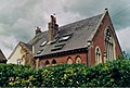
 Broughton school house - geograph.org.uk - 970865.jpg 640 × 427; 185 KB
-
 Broughton village sign - geograph.org.uk - 970848.jpg 427 × 640; 187 KB
-
 Broughton Village Well, High Street, Broughton (NHLE Code 1339092) (July 2022).JPG 2,400 × 1,800; 1.62 MB
-
 Buckholt Road, near Church Farm - geograph.org.uk - 1862082.jpg 2,816 × 2,112; 1.92 MB
-
 Byway between Broughton and Houghton - geograph.org.uk - 2841952.jpg 640 × 480; 70 KB
-
 Byway joining the Roman road - geograph.org.uk - 1870980.jpg 640 × 480; 230 KB
-
 Calves at Manor Farm, Broughton - geograph.org.uk - 151950.jpg 640 × 480; 367 KB
-
 Clarendon Way approaching Hayter's Copse - geograph.org.uk - 1863887.jpg 2,816 × 2,112; 3.1 MB
-
 Clarendon Way descending in Smith's Plantation - geograph.org.uk - 1862079.jpg 2,816 × 2,112; 2.82 MB
-
 Clarendon Way into Broughton - geograph.org.uk - 1881285.jpg 4,000 × 3,000; 2.91 MB
-
 Clarendon Way with ragwort - geograph.org.uk - 2701306.jpg 640 × 427; 156 KB
-
 Corner of woodland near Honeycomb - geograph.org.uk - 3643111.jpg 640 × 427; 72 KB
-
 Crop fields beside the A30 - geograph.org.uk - 5764107.jpg 640 × 427; 103 KB
-
 Crossing the A30 - geograph.org.uk - 4724244.jpg 640 × 473; 92 KB
-
 Cyclists on Broughton Drove - geograph.org.uk - 2701318.jpg 640 × 427; 150 KB
-
 Dovecote in St Mary's churchyard, Broughton - geograph.org.uk - 5962008.jpg 1,024 × 683; 190 KB
-
 Entering Broughton on Buckholt road - geograph.org.uk - 1878396.jpg 4,000 × 3,000; 2.61 MB
-
 Evening view towards Broughton - geograph.org.uk - 4375971.jpg 640 × 427; 73 KB
-

-
 Farm entrance, Stoney Batter - geograph.org.uk - 475493.jpg 570 × 418; 53 KB
-
 Field and hilltop trees, Buckholt 2 - geograph.org.uk - 478325.jpg 640 × 480; 74 KB
-
 Field at Houghton Drayton - geograph.org.uk - 2701280.jpg 640 × 427; 104 KB
-

-
 Fire plate, Broughton - geograph.org.uk - 928934.jpg 480 × 640; 63 KB
-
 Foords Barn, Broughton - geograph.org.uk - 1863213.jpg 2,816 × 2,112; 1.68 MB
-
 Footbridge over Wallop Brook - geograph.org.uk - 5961999.jpg 1,024 × 683; 261 KB
-
 Footpath below Broughton Down - geograph.org.uk - 2877472.jpg 640 × 480; 111 KB
-
 Footpath beside Wallop Brook - geograph.org.uk - 1863877.jpg 2,816 × 2,112; 2.61 MB
-
 Footpath in Broughton - geograph.org.uk - 182487.jpg 640 × 480; 329 KB
-
 Footpath, cycling prohibited - geograph.org.uk - 970853.jpg 640 × 427; 155 KB
-
 Ford at Broughton - geograph.org.uk - 4806406.jpg 1,086 × 724; 469 KB
-
 Former Broughton Methodist Chapel - geograph.org.uk - 2515560.jpg 1,600 × 1,082; 487 KB
-
 Garage at High Street, Broughton (July 2022).JPG 3,000 × 2,000; 2.6 MB
-
 Grassy track near Broughton - geograph.org.uk - 2877460.jpg 640 × 480; 129 KB
-
 High Street, Broughton - geograph.org.uk - 1863191.jpg 2,816 × 2,112; 1.56 MB
-
 Horsebridge Road - geograph.org.uk - 3109108.jpg 640 × 480; 97 KB
-

-
 Horsebridge Road, Broughton - geograph.org.uk - 6256219.jpg 2,592 × 1,944; 1.95 MB
-
 Junction of the A30 Salisbury Rd with the Broughton Rd - geograph.org.uk - 2044195.jpg 3,072 × 2,304; 3.41 MB
-
 Lane disappearing into woodland - geograph.org.uk - 3643088.jpg 640 × 427; 99 KB
-
 Lane near Manor Farm - geograph.org.uk - 3109093.jpg 640 × 480; 99 KB
-
 Late June in Broughton (i) - geograph.org.uk - 2495278.jpg 480 × 640; 81 KB
-
 Late June in Broughton (ii) - geograph.org.uk - 2495279.jpg 640 × 480; 60 KB
-
 Long straight road towards Danebury - geograph.org.uk - 2841927.jpg 640 × 480; 70 KB
-
 Man at work in Broughton - geograph.org.uk - 970856.jpg 640 × 427; 166 KB
-
 Minor road junction on B3084 - geograph.org.uk - 3643135.jpg 640 × 427; 89 KB
-
 Nether Wallop - Dairy Unit - geograph.org.uk - 1810742.jpg 640 × 480; 76 KB
-
 Nether Wallop - Dairy Unit - geograph.org.uk - 1810750.jpg 640 × 480; 88 KB
-
 Nether Wallop - Dairy Unit - geograph.org.uk - 1810754.jpg 640 × 480; 66 KB
-
 Nine Mile Cross near Nether Wallop - geograph.org.uk - 3109058.jpg 640 × 480; 77 KB
-
-

-
 Permissive Path - geograph.org.uk - 3849582.jpg 4,320 × 2,432; 3.09 MB
-
 Permissive Path Information sign - geograph.org.uk - 3849593.jpg 2,432 × 4,320; 1.77 MB
-
-
 Property named Hayters at Broughton - geograph.org.uk - 2701289.jpg 640 × 427; 118 KB
-

-
 Roman road heading east - geograph.org.uk - 1870986.jpg 640 × 480; 205 KB
-
 Salisbury Road near Junction with A30 - geograph.org.uk - 5468327.jpg 640 × 427; 377 KB
-
 Sculpture at Broughton - geograph.org.uk - 970845.jpg 640 × 427; 219 KB
-
 Thatched cob wall near Broughton - geograph.org.uk - 1881296.jpg 4,000 × 3,000; 2.9 MB
-
 Thatched house in Broughton - geograph.org.uk - 4724260.jpg 640 × 458; 131 KB
-
 The A30 at Chattis Hill - geograph.org.uk - 3492301.jpg 800 × 600; 115 KB
-
 The A30 at Nine Mile Water Farm - geograph.org.uk - 151954.jpg 640 × 480; 338 KB
-
 The A30 at the Broughton turn off - geograph.org.uk - 3492295.jpg 800 × 600; 174 KB
-
 The B3084 near Broughton - geograph.org.uk - 6256213.jpg 2,592 × 1,944; 1.7 MB
-
-
 The Greyhound in Broughton - geograph.org.uk - 4724278.jpg 640 × 457; 114 KB
-
 The Valley of the Wallop Brook at Nine Mile Water Farm - geograph.org.uk - 2044202.jpg 3,072 × 2,304; 2.25 MB
-
 The well, High Street, Broughton - geograph.org.uk - 183737.jpg 640 × 480; 269 KB
-
-
 Track leading to Wallop Brook - geograph.org.uk - 1863890.jpg 2,816 × 2,112; 2.29 MB
-
 Track towards The Buildings - geograph.org.uk - 2841958.jpg 640 × 480; 79 KB
-
 Two trees near Broughton - geograph.org.uk - 2842027.jpg 640 × 480; 46 KB
-

-

-

-
 Village Hall, Broughton - geograph.org.uk - 347054.jpg 640 × 480; 86 KB
-
 Village scene Broughton.jpg 640 × 480; 91 KB
-
 Wallop Brook - Nine Mile Water - geograph.org.uk - 2152349.jpg 1,280 × 960; 460 KB
-
 Weather vane, Broughton - geograph.org.uk - 928939.jpg 640 × 574; 40 KB
-
 Weather vane, Broughton - geograph.org.uk - 928941.jpg 640 × 572; 29 KB
-
 West View Stores, Broughton - geograph.org.uk - 970859.jpg 640 × 427; 166 KB
-
 Wooded track near Eveley Farm - geograph.org.uk - 2841935.jpg 640 × 480; 166 KB
-

-

-

-
 Barns near Stoney Batter - geograph.org.uk - 475488.jpg 640 × 480; 115 KB
-
 Bossington Farm - geograph.org.uk - 182343.jpg 640 × 480; 314 KB
-
 Bridleway near Stoney Batter 1 - geograph.org.uk - 475482.jpg 480 × 640; 185 KB
-
 Bridleway near Stoney Batter 2 - geograph.org.uk - 475486.jpg 640 × 480; 165 KB
-
 Broughton - High Street - geograph.org.uk - 755903.jpg 640 × 480; 91 KB
-
 Broughton - The Old School House - geograph.org.uk - 755950.jpg 640 × 480; 136 KB
-
 Broughton - Village Hall - geograph.org.uk - 756070.jpg 640 × 480; 119 KB
-
 Broughton village centre - geograph.org.uk - 182468.jpg 640 × 480; 301 KB
-
 Byway near Broughton Down 1 - geograph.org.uk - 463883.jpg 640 × 480; 177 KB
-
 Byway near Broughton Down 2 - geograph.org.uk - 476559.jpg 640 × 480; 145 KB
-
 Byway near Buckholt Farm - geograph.org.uk - 479130.jpg 640 × 480; 169 KB
-
 Byway near Stoney Batter - geograph.org.uk - 474875.jpg 480 × 640; 209 KB
-
 Byway on Steven's Drove, Houghton - geograph.org.uk - 123823.jpg 427 × 640; 191 KB
-

-
 Downland, Nether Wallop - geograph.org.uk - 464992.jpg 640 × 480; 104 KB
-
 Dowse's Charity School, Broughton - geograph.org.uk - 347046.jpg 640 × 480; 136 KB
-
 Eveley Farm, Houghton - geograph.org.uk - 123607.jpg 640 × 366; 145 KB
-
 Farm land west of North Houghton - geograph.org.uk - 123603.jpg 640 × 427; 128 KB
-
 Farmland, Broughton - geograph.org.uk - 461266.jpg 640 × 480; 126 KB
-
 Farmland, Broughton - geograph.org.uk - 463588.jpg 640 × 480; 122 KB
-
 Farmland, Broughton - geograph.org.uk - 463613.jpg 640 × 480; 157 KB
-
 Farmland, Broughton - geograph.org.uk - 465186.jpg 640 × 480; 122 KB
-
 Farmland, Broughton - geograph.org.uk - 517849.jpg 640 × 480; 177 KB
-
 Farmland, Broughton - geograph.org.uk - 518764.jpg 640 × 480; 196 KB
-
 Farmland, Buckholt - geograph.org.uk - 461273.jpg 640 × 480; 142 KB
-
 Farmland, East Tytherley - geograph.org.uk - 517853.jpg 640 × 480; 149 KB
-
 Field and woods near East Tytherley - geograph.org.uk - 477441.jpg 640 × 480; 130 KB
-
 Field at Bossington Farm - geograph.org.uk - 182363.jpg 640 × 480; 343 KB
-
 Field near Broughton 1 - geograph.org.uk - 476556.jpg 640 × 480; 92 KB
-
 Field near Broughton 2 - geograph.org.uk - 476557.jpg 640 × 480; 93 KB
-

-

-
 Ford, Broughton - geograph.org.uk - 71458.jpg 480 × 360; 31 KB
-
 Oak tree near East Tytherley - geograph.org.uk - 463869.jpg 640 × 480; 138 KB
-
 Oak tree near East Tytherley 2 - geograph.org.uk - 477446.jpg 640 × 480; 98 KB
-
 Outskirts of Houghton Drayton - geograph.org.uk - 179220.jpg 640 × 480; 122 KB
-
 Parkland, Hildon House - geograph.org.uk - 463551.jpg 640 × 480; 137 KB
-
 Road junction near Stoney Batter - geograph.org.uk - 474894.jpg 640 × 480; 93 KB
-

-
 Roman road near Broughton - geograph.org.uk - 476555.jpg 640 × 480; 106 KB
-
 Stoney Batter Lane near Stoney Batter - geograph.org.uk - 475468.jpg 480 × 640; 132 KB
-
 Stubble, East Tytherley - geograph.org.uk - 517858.jpg 640 × 480; 178 KB
-
 The B3084 - geograph.org.uk - 465158.jpg 640 × 480; 182 KB
-
 The Buildings, NE of Broughton - geograph.org.uk - 123612.jpg 640 × 427; 151 KB
-
 The Thatch, Broughton - geograph.org.uk - 347050.jpg 640 × 480; 115 KB
-
 Track near Stoney Batter - geograph.org.uk - 475492.jpg 480 × 640; 102 KB
-
 View towards Broughton - geograph.org.uk - 182476.jpg 640 × 480; 361 KB
-
 Village sign, Broughton - geograph.org.uk - 347017.jpg 640 × 480; 121 KB
-
 Village sign, The Pound, Broughton - geograph.org.uk - 183732.jpg 640 × 480; 338 KB
-
 Wallop Brook - geograph.org.uk - 182465.jpg 640 × 480; 350 KB


_(July_2022).JPG)


.JPG)


_-_geograph.org.uk_-_2495278.jpg)
_-_geograph.org.uk_-_2495279.jpg)


_RMG_PW4934.jpg)


_-_geograph.org.uk_-_5136083.jpg)
_-_geograph.org.uk_-_5136088.jpg)
_-_geograph.org.uk_-_5136094.jpg)


